

When planning for our 2021 trip to Greece, a hike to Martsalos Beach in Crete was a must on our list. We enjoy the out of the way beaches in Crete. It is a lot of fun for us to hike to the beach, swim, and make our way back. We also wanted to hike to Agiofaraggo Beach but we knew we did not have the time to do both. Agiofaraggo will have to wait until our next trip to Crete.
The hike itself is 2 km (1.24 miles) and it took us about 45 minutes on the way down as we took lots of photos. It is an out and back trail. The way back took a little less than an hour as we stopped and took more photo.
Location
Martsalos Beach is a bit more than 2 hours South and East of Rethymno along the Lithino Cape on the west side of the Asterousia Mountains. Although it is a bit of a drive we started off early morning and enjoyed the countryside. This is also a very remote area and you will be driving on rough dirt roads. If you plug this into your google maps the directions are pretty much spot on. That being said, mark your destination as Martsalo, Gorge.

Getting There
On Google Maps, we had originally marked our destination as Martsalo Beach. Google maps took us past the entrance to an even more isolated and steep area and told us we had “arrived” although we were in the middle of an uphill road! Our GPS service was very intermittent throughout the trip but lucky for us we backed tracked and were able to find the entrance. Later, we realized our destination in Google Maps was actually Martsalo Gorge, not Martsalo Beach.
Other than Google Maps, we really had no trouble finding the area as there are small signs along the way. Note that some signs are only written in Greek so I was glad I studied the Greek alphabet this trip.

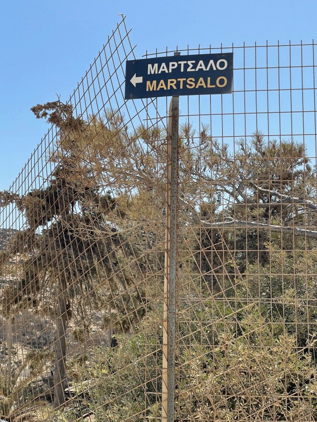
As mentioned above, we originally passed the gate into Martsalos. We remembered seeing it, but noticed the gate was closed so continued thinking there is an alternative entrance. If there is, we didn’t find it. When we back tracked, we saw a car pull out of the area and then shut the gate. To the right of the gate was the Martsalos sign so we opened the gate, drove through, and shut the gate. (Marked Point A on map). This road took us to the church pictured below.

The church marks the point where you can start your hike if you don’t have 4 wheel drive. (Marked Point B on map). We did so we continued down a bit further until the end of the road, which saved us from a longer hike back out. There was a young couple from France who asked if they could ride from the church to the path so they could take the shorter route. We gave them the ride and enjoyed their company.

On to the Cave Church
We started off on our path towards the Martsalos Panagia which is a church built into a cave along the path. There were lots of steps but they were not difficult, although I was already thinking how we would have to climb back up on the way back!


The Church cave, below, was once used as a catacomb during persecution times. There are other areas built into caves here and it’s my understanding this is a retreat or hermitage for the nearby Odigitria Monastery Regardless, it is considered a religious area so it is expected to be quiet and respectful through this area. We did not enter any of the buildings or church as we did not know if it is permissible. (Marked Point C on map)

Martsalo Gorge
There was no distinct signs through the gorge but it was easy to see the destination so we just followed paths and some cairns. Climbing down from the Cave Church to the floor bed of the gorge took some careful footing but otherwise the hike was not difficult. It was hot though. I was glad to have a hat on!

Palm Forrest
Once you are on the gorge floor, you will walk towards the tall palm trees in the middle of the gorge! There are only a few, but they are endemic to this area. These are called the Phoenix Theophrastus Palm Trees also know as the Cretan Date Palm. They are native to a few sites in Crete, Southern Greece and some surrounding Islands. We noticed both on the way up and back that the goats like this area! You can hear the goat bells from a distance and there seems to be quite a few in the area. Sometimes it was the only sound we heard in this remote area. (Marked Point D on Map).


After walking past the small palm forrest, the trail continues to slowly descend towards the sea.


At Martsalos Beach
We continued on to the beach and enjoyed a refreshing swim in the sea. Other than us and the couple who went down with us, there was only 3 other couples there. There were more goats than people at the beach! When you hike in Crete, you will see plenty of goats and this is true at Martsalos Beach also. The water was crystal clear and we enjoyed snorkeling, swimming, and just hanging out. One thing to remember though, the beach was rocky as was the sea floor. We wore water shoes and they were definitely a good choice. We spent the rest of the morning here and hated to leave. The walk up was not that bad other than it was up hill!


Conclusion
The hike to Martsalos Beach in Crete was one of the highlights for me of this trip. Next time we are in Crete, we are definitely going to hike to Agiofaraggo Beach and if we have time we will return to Martsalos Beach. If you enjoy hiking, I would totally recommend this!
Where We Stayed
While in this area of Crete we stayed at the Avli Lounge Apartments in Rethymno and could not have been happier. Staying here was very special. The room was comfortable, clean, had lots of space and nicely decorated. The service was outstanding. We enjoyed breakfast in the restaurant each morning and it was so fresh and good. I highly recommend Avli when in the Rethymno area.


Planning & Tips
If you plan on using your cell phone a lot for GPS or taking photos I found this I Walk phone charger to be a great tool. The vehicles we drove in Greece did not have phone charges adaptable to our I phones. This lightweight easy to carry charger saved me many times.
I also bought a National Geographic Map of Crete which was was priceless as we lost our GPS several times. The map is pretty accurate and durable. Although quite large it folds up like a typical map. Half of Crete is on one side of of the map and the other half of Crete is on the other side. I did have a bit of flipping around but it worked pretty well.
While planning our trips to Crete, I found the travel guide Top 10 Crete to be very useful. For one thing, it lists the top 10 places to go, restaurants, and sites. Additionally, it also lists the top 10 by region and area. Given these points, I felt it was a great planning tool, plus it came with a pocket size map which we did use.
Follow Me on Instagram!
Follow these links for more posts of my 2021 Greece Vacay:
Elounda Peninsula All Suite Hotel, Revisited 2021
Ancient City of Lato, Sept 2021
Aforesmenos Lighthouse, Crete, Sept 2021
Avli Hotel and Restaurant, Sept 2021
The Chapel in the Sea, Georgioupoli Sept, 2021
Koutalas Beach and Sea Cave, Sept 2021
A Walk Through Chania, Sept 2021
Temple of Poseidon, Septs 2021
You can also follow my other Crete adventures here:
Elounda Peninsula Hotel, Sept 2019
Knossos Palace, Crete Sept 2019
Seitan Limania Beach, Sept 2019
Katholiko Monastery, Sept 2019
Links to our 2018 and also 2019 Trip can be found in this post:
10 Days in Greece Athens, Crete, Santorini 2019
8 Days in Greece, Athens, Milos, Santorini 2018
Diary of a Gen-X recommendations for hotels and restaurants are based on our own experiences. We do not receive compensation for recommending at any of these nor are we affiliates of any hotels or restaurants. The only hotels we recommend are places we stayed which are clean, comfortable, and provided exceptional hospitality.
Diary of a Gen-X Traveler contains affiliate links, including Amazon. This means I get a small commission for each qualifying purchase through my links. Thank you!